Benchmark on 'The Farm'
Introduction
The photograph on this page of Benchmark on 'The Farm' by Roger Templeman as part of the Geograph project.
The Geograph project started in 2005 with the aim of publishing, organising and preserving representative images for every square kilometre of Great Britain, Ireland and the Isle of Man.

There are currently over 7.5m images from over 14,400 individuals and you can help contribute to the project by visiting https://www.geograph.org.uk
Benchmark on 'The Farm'
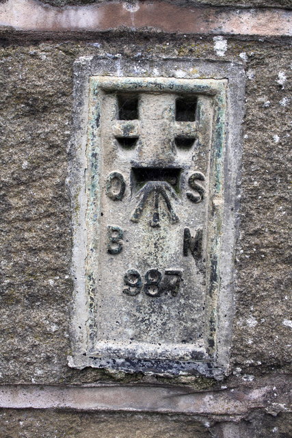
Image: © Roger Templeman Taken: 10 Aug 2015
Ordnance Survey flush bracket (serial number 987) benchmark described on the Bench Mark Database at http://www.bench-marks.org.uk/bm1566
Images are licensed for reuse under creativecommons.org/licenses/by-sa/2.0
Image Location


Leaflet Map data © OpenStreetMap
Latitude
53.949519
Longitude
-2.017181