Deanery Farm, Lanchester
Introduction
The photograph on this page of Deanery Farm, Lanchester by Robert Graham as part of the Geograph project.
The Geograph project started in 2005 with the aim of publishing, organising and preserving representative images for every square kilometre of Great Britain, Ireland and the Isle of Man.

There are currently over 7.5m images from over 14,400 individuals and you can help contribute to the project by visiting https://www.geograph.org.uk
Deanery Farm, Lanchester
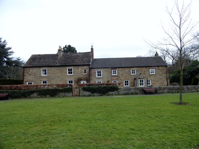
Image: © Robert Graham Taken: 11 Mar 2015
This former farm stands beside the village green. The farmhouse on the left is C18, the right hand half of the building was originally a byer added in the C19. Now all residential.
Images are licensed for reuse under creativecommons.org/licenses/by-sa/2.0
Image Location
Latitude
54.821621
Longitude
-1.741618