Croxley Rail Link (13): Site of the former Watford West Station
Introduction
The photograph on this page of Croxley Rail Link (13): Site of the former Watford West Station by Nigel Cox as part of the Geograph project.
The Geograph project started in 2005 with the aim of publishing, organising and preserving representative images for every square kilometre of Great Britain, Ireland and the Isle of Man.

There are currently over 7.5m images from over 14,400 individuals and you can help contribute to the project by visiting https://www.geograph.org.uk
Croxley Rail Link (13): Site of the former Watford West Station
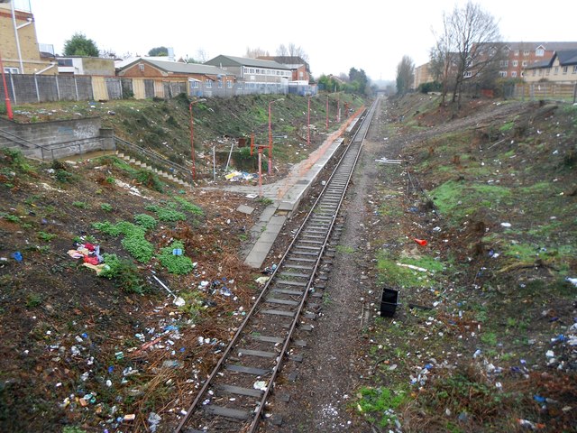
Image: © Nigel Cox Taken: 13 Dec 2015
This is the former Watford West station, dating from 1912 and the opening of the L&NWR's Croxley Branch. The new Croxley Rail Link, now known as the Metropolitan Line Extension, would utilize the trackbed through here, but it is not planned to re-open the old station. The trackside vegetation has been cleared in preparation for the link and the extents of the old station can be seen from the Tolpits Lane bridge for the first time in many years. Little other than the platform, steps and lamp posts remain and the litter is a real eyesore. This view has now been taken and submitted to Geograph in:- September 1985 Image April 2005 Image March 2008 Image March 2013 Image August 2013 Image
Images are licensed for reuse under creativecommons.org/licenses/by-sa/2.0
Image Location
Latitude
51.648296
Longitude
-0.413822