Croxley Rail Link (12): Site of the proposed Watford Vicarage Road Station
Introduction
The photograph on this page of Croxley Rail Link (12): Site of the proposed Watford Vicarage Road Station by Nigel Cox as part of the Geograph project.
The Geograph project started in 2005 with the aim of publishing, organising and preserving representative images for every square kilometre of Great Britain, Ireland and the Isle of Man.

There are currently over 7.5m images from over 14,400 individuals and you can help contribute to the project by visiting https://www.geograph.org.uk
Croxley Rail Link (12): Site of the proposed Watford Vicarage Road Station
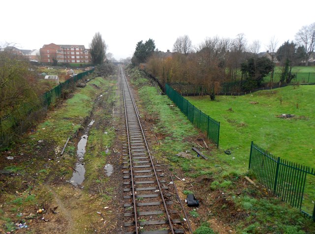
Image: © Nigel Cox Taken: 13 Dec 2015
Compare this view with Image taken in August 2013 to see how the trackside vegetation has been cleared in preparation for the link. Following a public consultation the name of the new station has been changed. The Croxley Rail Link is now formally known as the Metropolitan Line Extension.
Images are licensed for reuse under creativecommons.org/licenses/by-sa/2.0
Image Location
Latitude
51.647073
Longitude
-0.409817