Broken Give Way sign on a corner near Shifnal
Introduction
The photograph on this page of Broken Give Way sign on a corner near Shifnal by Jaggery as part of the Geograph project.
The Geograph project started in 2005 with the aim of publishing, organising and preserving representative images for every square kilometre of Great Britain, Ireland and the Isle of Man.

There are currently over 7.5m images from over 14,400 individuals and you can help contribute to the project by visiting https://www.geograph.org.uk
Broken Give Way sign on a corner near Shifnal
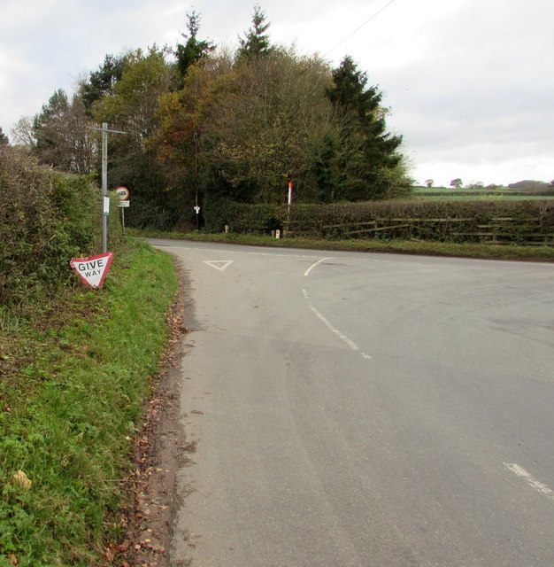
Image: © Jaggery Taken: 16 Nov 2015
In mid-November 2015, the triangular sign is on the grass below its post on a bank on the corner of Nanny Murphy's Lane and the B4379. Its demise has taken some time, based on the evidence of a May 2011 Google Earth Street View when the sign was on the post, but facing the hedge not Nanny Murphy's Lane. Presumably one or more vehicle collisions over the years loosened the screws securing the sign to the post.
Images are licensed for reuse under creativecommons.org/licenses/by-sa/2.0
Image Location


Leaflet Map data © OpenStreetMap
Latitude
52.687677
Longitude
-2.361372