Flood on Magdalen's Road
Introduction
The photograph on this page of Flood on Magdalen's Road by Gordon Hatton as part of the Geograph project.
The Geograph project started in 2005 with the aim of publishing, organising and preserving representative images for every square kilometre of Great Britain, Ireland and the Isle of Man.

There are currently over 7.5m images from over 14,400 individuals and you can help contribute to the project by visiting https://www.geograph.org.uk
Flood on Magdalen's Road
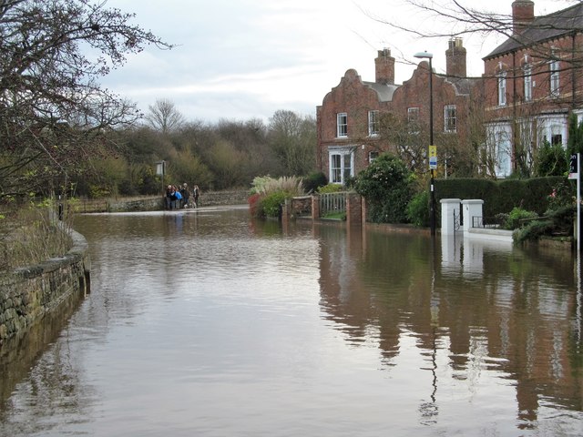
Image: © Gordon Hatton Taken: 6 Dec 2015
Probably the only road in the city to be flooded on December 6th 2015 as a result of heavy rains in the dales caused by storm 'Desmond'. The Ure overtopped its banks in several areas along its course, but fortunately in Ripon no properties were affected.
Images are licensed for reuse under creativecommons.org/licenses/by-sa/2.0
Image Location


Leaflet Map data © OpenStreetMap
Latitude
54.142322
Longitude
-1.516095