Shields Ferry Office & Alum Ale House, South Shields
Introduction
The photograph on this page of Shields Ferry Office & Alum Ale House, South Shields by Andrew Curtis as part of the Geograph project.
The Geograph project started in 2005 with the aim of publishing, organising and preserving representative images for every square kilometre of Great Britain, Ireland and the Isle of Man.

There are currently over 7.5m images from over 14,400 individuals and you can help contribute to the project by visiting https://www.geograph.org.uk
Shields Ferry Office & Alum Ale House, South Shields
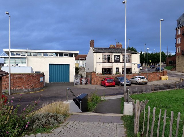
Image: © Andrew Curtis Taken: 27 Nov 2015
Previously named the Ferry Boat Hotel, the Alum Ale House is a Grade II Listed Building known as 'Alum House Ham (Tyne Dock Engineering Co. Ltd.)'. The 'ham' in the name refers to an old landing place on the River Tyne. Alum shale was brought in from around Whitby for the local chemical industry, first recorded around 1720. It was landed at the ‘ham’, which at various times over the centuries has also been a landing point for scullerboats and a site for boat building and sail making. Not always a pub, it was previously used by the Home Guard during the Second World War, as offices of Tyne Dock Engineering and by a furnishing company. It is reputed to be haunted by a variety of its past incumbents and visitors. http://www.shieldsgazette.com/time-of-our-lives/hamming-it-up-at-the-alum-house-1-4126072 The Alum House is the oldest licensed premises in South Shields. Some parts of the building date back to the seventeenth century and the quaint and higgledy-piggledy layout of the interior reflects its antiquity. The alehouse stood on what was originally Alum Ham, the public landing place where scullermen once gathered to row passengers across the Tyne. The river was more of a thoroughfare in those days than a barrier, and intercourse between North and South Shields was much more frequent. http://papastonch.blogspot.co.uk/2008/08/alum-house-south-shields.html
Images are licensed for reuse under creativecommons.org/licenses/by-sa/2.0
Image Location
Latitude
54.997635
Longitude
-1.439428