New Cross: Former public house
Introduction
The photograph on this page of New Cross: Former public house by Dr Neil Clifton as part of the Geograph project.
The Geograph project started in 2005 with the aim of publishing, organising and preserving representative images for every square kilometre of Great Britain, Ireland and the Isle of Man.

There are currently over 7.5m images from over 14,400 individuals and you can help contribute to the project by visiting https://www.geograph.org.uk
New Cross: Former public house
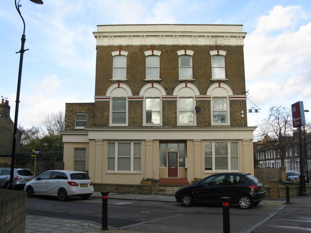
Image: © Dr Neil Clifton Taken: 1 Dec 2015
A sight all too common in London as elsewhere in the UK, is the former public house no longer in use as such. This one, at the junction of Barlborough Street and Monson Road, was the 'Duke of Albany'. (date of closure not known - to me, anyway).
Images are licensed for reuse under creativecommons.org/licenses/by-sa/2.0
Image Location
Latitude
51.47795
Longitude
-0.047911