Rookery Hall
Introduction
The photograph on this page of Rookery Hall by Ian Taylor as part of the Geograph project.
The Geograph project started in 2005 with the aim of publishing, organising and preserving representative images for every square kilometre of Great Britain, Ireland and the Isle of Man.

There are currently over 7.5m images from over 14,400 individuals and you can help contribute to the project by visiting https://www.geograph.org.uk
Rookery Hall
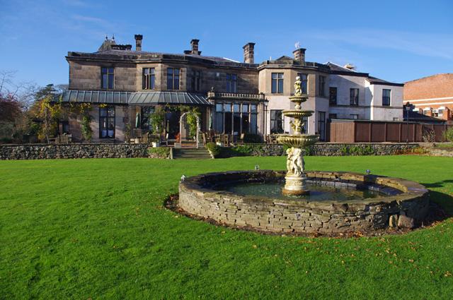
Image: © Ian Taylor Taken: 22 Nov 2015
Lawn and fountain to the east of the Grade II Listed Building. See https://historicengland.org.uk/listing/the-list/list-entry/1136513 The original part (on left) is early 19th century. Now converted to a luxury hotel, wedding and conference venue.
Images are licensed for reuse under creativecommons.org/licenses/by-sa/2.0
Image Location
Latitude
53.09876
Longitude
-2.509227