Nutley Hall pub sign
Introduction
The photograph on this page of Nutley Hall pub sign by Ian Capper as part of the Geograph project.
The Geograph project started in 2005 with the aim of publishing, organising and preserving representative images for every square kilometre of Great Britain, Ireland and the Isle of Man.

There are currently over 7.5m images from over 14,400 individuals and you can help contribute to the project by visiting https://www.geograph.org.uk
Nutley Hall pub sign
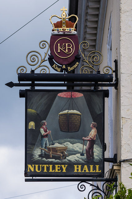
Image: © Ian Capper Taken: 25 May 2013
Sign for the former Nutley Hall pub in Nutley Lane (see Image). Although the pub was closed in 2012 and has since been converted to housing, the sign has been retained. The crest on top shows it was once a King and Barnes pub (although its final owner was Hall & Woodhouse, who took over King and Barnes in 2000), while the sign itself depicts sand miners - underneath the building is a cave dug out of the sand, one of a number of such caves under the centre of Reigate.
Images are licensed for reuse under creativecommons.org/licenses/by-sa/2.0
Image Location
Latitude
51.239226
Longitude
-0.211052