Partially dewatered Regent's Canal
Introduction
The photograph on this page of Partially dewatered Regent's Canal by Robin Webster as part of the Geograph project.
The Geograph project started in 2005 with the aim of publishing, organising and preserving representative images for every square kilometre of Great Britain, Ireland and the Isle of Man.

There are currently over 7.5m images from over 14,400 individuals and you can help contribute to the project by visiting https://www.geograph.org.uk
Partially dewatered Regent's Canal
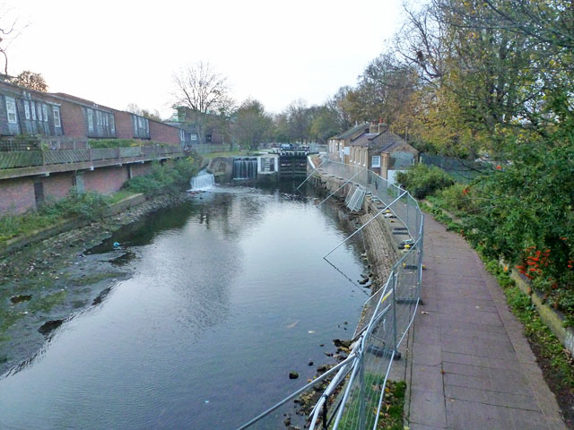
Image: © Robin Webster Taken: 21 Nov 2015
The junction pound below Old Ford Lock has been drained for wall and bank repairs. The joining Hertford Union Canal behind the camera has been stanked off in the entrance narrows, with pumps across the stank to assist the drainage. There is inevitably a flow into the pound via the Old Ford overflow weirs, as may be seen.
Images are licensed for reuse under creativecommons.org/licenses/by-sa/2.0
Image Location


Leaflet Map data © OpenStreetMap
Latitude
51.53204
Longitude
-0.045165