Guide Stone (rear view); Grade II listed
Introduction
The photograph on this page of Guide Stone (rear view); Grade II listed by David Rogers as part of the Geograph project.
The Geograph project started in 2005 with the aim of publishing, organising and preserving representative images for every square kilometre of Great Britain, Ireland and the Isle of Man.

There are currently over 7.5m images from over 14,400 individuals and you can help contribute to the project by visiting https://www.geograph.org.uk
Guide Stone (rear view); Grade II listed
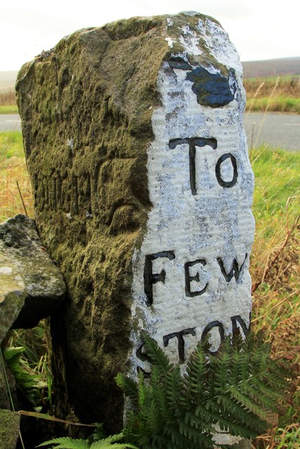
Image: © David Rogers Taken: 16 Nov 2015
At the junction of Hardisty Hill and Meagill Lane. The rear surface has been retooled and carries the remains of an earlier inscription "OUGH", which may have once read "SCOUGH", the pre C19 spelling of Scow Hall, Norwood.
Images are licensed for reuse under creativecommons.org/licenses/by-sa/2.0
Image Location


Leaflet Map data © OpenStreetMap
Latitude
54.008119
Longitude
-1.744695