War memorial at Witton Gilbert
Introduction
The photograph on this page of War memorial at Witton Gilbert by Trevor Littlewood as part of the Geograph project.
The Geograph project started in 2005 with the aim of publishing, organising and preserving representative images for every square kilometre of Great Britain, Ireland and the Isle of Man.

There are currently over 7.5m images from over 14,400 individuals and you can help contribute to the project by visiting https://www.geograph.org.uk
War memorial at Witton Gilbert
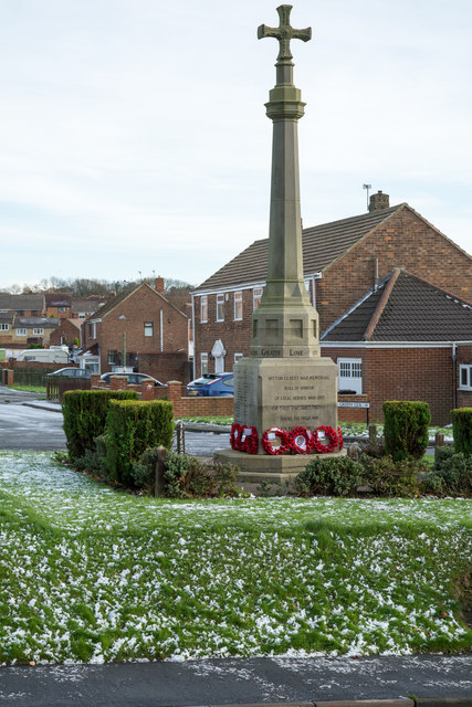
Image: © Trevor Littlewood Taken: 21 Nov 2015
The memorial is slightly elevated above the east side of the B6312 at the northern end of the village. The houses of Green Lea are seen behind the monument. Remnants of the first snow of the winter are on the ground.
Images are licensed for reuse under creativecommons.org/licenses/by-sa/2.0
Image Location
Latitude
54.81101
Longitude
-1.634016