
Tree, Stockton Down near Stockton
Introduction
The photograph on this page of Tree, Stockton Down near Stockton by Andy Gryce as part of the Geograph project.
The Geograph project started in 2005 with the aim of publishing, organising and preserving representative images for every square kilometre of Great Britain, Ireland and the Isle of Man.

There are currently over 7.5m images from over 14,400 individuals and you can help contribute to the project by visiting https://www.geograph.org.uk
Tree, Stockton Down near Stockton
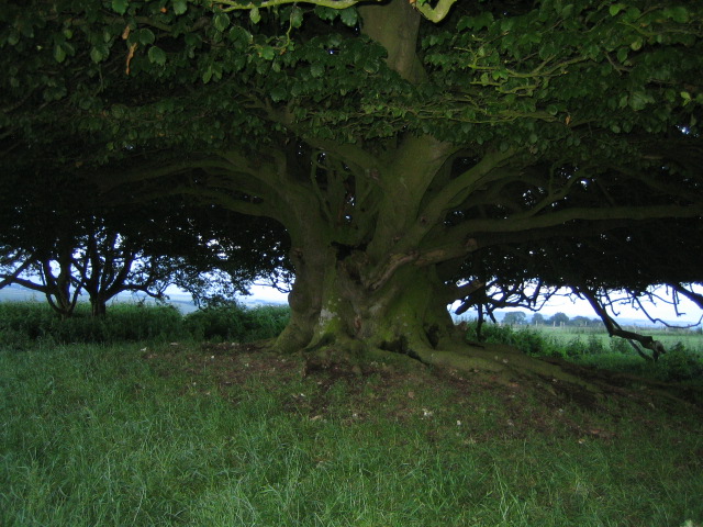
Image: © Andy Gryce Taken: 15 Jun 2007
This tree is one of a pair of isolated trees alongside the bridleway that runs north to south across Stockton Down close to its intersection with a restricted byway, see Image This might be a hazel tree that was coppiced a long time ago, but which has not been cut back since. Coppicing is the regular cutting off of new shoots of a tree near its base every five to seven years to provide a steady supply of wood for wattle fencing, hurdles, building construction and charcoal. If there was livestock grazing at the time however, as there is now, the coppiced tree would need to be protected to prevent the new shoots being eaten.
Images are licensed for reuse under creativecommons.org/licenses/by-sa/2.0
Image Location

Latitude
51.127228
Longitude
-2.052394