Yonder Bognie Recumbent Stone Circle (4)
Introduction
The photograph on this page of Yonder Bognie Recumbent Stone Circle (4) by Anne Burgess as part of the Geograph project.
The Geograph project started in 2005 with the aim of publishing, organising and preserving representative images for every square kilometre of Great Britain, Ireland and the Isle of Man.

There are currently over 7.5m images from over 14,400 individuals and you can help contribute to the project by visiting https://www.geograph.org.uk
Yonder Bognie Recumbent Stone Circle (4)
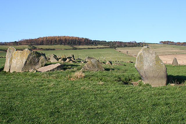
Image: © Anne Burgess Taken: 16 Nov 2015
Several of the stones still standing are visible in this view. At extreme left is the recumbent setting. Two of the orthostats are on the right, one close to the camera and one on the far side of the circle. The remaining stones are difficult to pick out among the dumped field boulders. Image]
Images are licensed for reuse under creativecommons.org/licenses/by-sa/2.0
Image Location
Latitude
57.500365
Longitude
-2.668249