Parking area at the top of Locke Street, Newport
Introduction
The photograph on this page of Parking area at the top of Locke Street, Newport by Jaggery as part of the Geograph project.
The Geograph project started in 2005 with the aim of publishing, organising and preserving representative images for every square kilometre of Great Britain, Ireland and the Isle of Man.

There are currently over 7.5m images from over 14,400 individuals and you can help contribute to the project by visiting https://www.geograph.org.uk
Parking area at the top of Locke Street, Newport
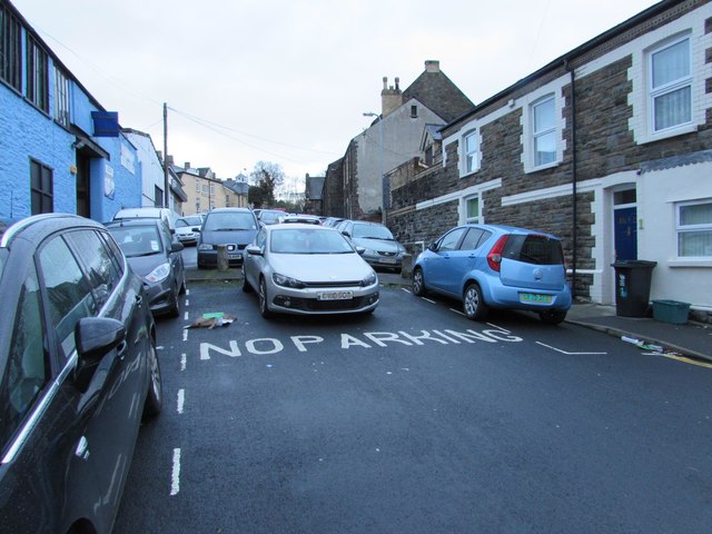
Image: © Jaggery Taken: 16 Nov 2015
Formerly a through route for motor vehicles from Factory Road to Queen's Hill, Locke Street is now blocked by concrete posts across the road. Two of the posts are in view, one on each side of the grey car. Queen's Hill is ahead, about 60 metres from the camera.
Images are licensed for reuse under creativecommons.org/licenses/by-sa/2.0
Image Location
Latitude
51.590911
Longitude
-2.999291