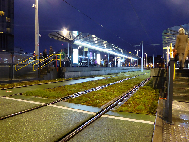
Deansgate Castlefield Metrolink Station
Introduction
The photograph on this page of Deansgate Castlefield Metrolink Station by David Dixon as part of the Geograph project.
The Geograph project started in 2005 with the aim of publishing, organising and preserving representative images for every square kilometre of Great Britain, Ireland and the Isle of Man.
There are currently over 7.5m images from over 14,400 individuals and you can help contribute to the project by visiting https://www.geograph.org.uk

Image: © David Dixon Taken: 5 Nov 2015
Looking across towards the new island platform at the Deansgate-Castlefield Metrolink stop. Originally, the stop had two platforms serving tracks running in separate directions. These platforms were ‘staggered’ with reduced length and confused access arrangements. It therefore had no capacity to operate as an ‘interchange’. Now work has been completed, the stop has a new inbound island platform and a new outbound platform, as well as improved access and facilities. Two new track cross-overs have also been installed, allowing trams to turn-back in both directions, making the stop an interchange. http://www.publicaccess.manchester.gov.uk/associateddocs/Default1.aspx?103196-dsx-0001.pdf pdf document with details of the upgrading of the Deansgate-Castlefield Metrolink stop (Ian Simpson Architects/Manchester City Council). As part of a “green theme” http://www.manchestereveningnews.co.uk/news/greater-manchester-news/deansgate-castlefield-living-wall-tram-9723668 , blocks of sedum have been planted between tracks which are already teeming with wildflowers so that the trams appear to move along a bed of grass as they pass through the stop.

