Derelict Westerwood Farmhouse
Introduction
The photograph on this page of Derelict Westerwood Farmhouse by Derek Ferris as part of the Geograph project.
The Geograph project started in 2005 with the aim of publishing, organising and preserving representative images for every square kilometre of Great Britain, Ireland and the Isle of Man.

There are currently over 7.5m images from over 14,400 individuals and you can help contribute to the project by visiting https://www.geograph.org.uk
Derelict Westerwood Farmhouse
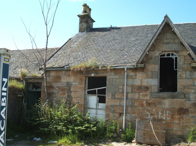
Image: © Derek Ferris Taken: 21 Jun 2007
Once a beautiful building. The farm and its land were bought over and converted into Westerwood Golf Course. Farmhouse and other farm buildings have been used as the course maintenance depot. Lack of maintenance on fabric of building and wanton vandalism over past years have left it in this sorry state. The accommodation has been supplemented with couple of portakabins now for security reasons. Around 150 years ago the farmhouse was originally built on the site of a Roman fort on the Antonine Wall. Remnants of the wall still exist a short distance away. Presume they had vandals in olden times too - that's why probably the wall was dismantled.
Images are licensed for reuse under creativecommons.org/licenses/by-sa/2.0
Image Location
Latitude
55.973549
Longitude
-3.987074