Byard's Leap memorial
Introduction
The photograph on this page of Byard's Leap memorial by Andy Stephenson as part of the Geograph project.
The Geograph project started in 2005 with the aim of publishing, organising and preserving representative images for every square kilometre of Great Britain, Ireland and the Isle of Man.

There are currently over 7.5m images from over 14,400 individuals and you can help contribute to the project by visiting https://www.geograph.org.uk
Byard's Leap memorial
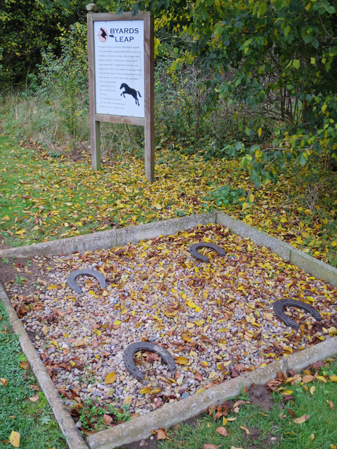
Image: © Andy Stephenson Taken: 3 Nov 2015
The story of Byard's Leap, states there was a witch called Old Meg, an evil person who plagued the local villagers from her cave or hut in a spinney near the turning to Sleaford called High Dike. She was a bane of the countryside and caused the crops to wither. A local champion, a retired soldier, came forward in response to the villagers' requests, and he asserted that he could kill her by driving a sword through her heart. To select a horse suitable for this task, he went to a pond where horses drank and dropped a stone in the pond, selecting the horse that reacted quickest, and this horse was known locally as 'Blind Byard', as he was blind. The champion went to the witch’s cave and called her out, but the witch refused, saying she was eating and he would have to wait. However, she crept up behind him and sank her long nails into the horse who ran, leaping over 60 feet (18 m). The champion regained control of the horse when they reached the pond, pursued by the witch, where he turned and thrust his sword into her heart, and she fell into the pond and drowned. The spot where Blind Byard landed is marked by four posts in the ground with horseshoes on, and a commemorative stone. According to http://coord.info/GC5WJH4
Images are licensed for reuse under creativecommons.org/licenses/by-sa/2.0
Image Location
Latitude
53.032275
Longitude
-0.52533