Former trolleybus turning circle, Dudley
Introduction
The photograph on this page of Former trolleybus turning circle, Dudley by Richard Vince as part of the Geograph project.
The Geograph project started in 2005 with the aim of publishing, organising and preserving representative images for every square kilometre of Great Britain, Ireland and the Isle of Man.

There are currently over 7.5m images from over 14,400 individuals and you can help contribute to the project by visiting https://www.geograph.org.uk
Former trolleybus turning circle, Dudley
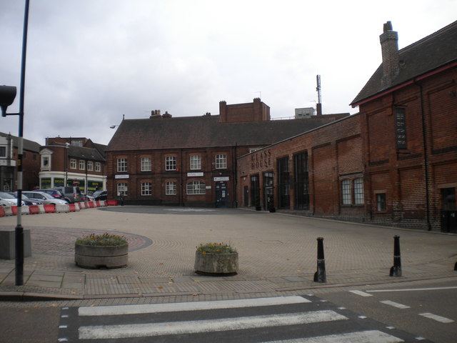
Image: © Richard Vince Taken: 10 Oct 2015
This small square, at the junction of Priory Street (foreground) and Stone Street (extreme left), was once a large turning circle for Wolverhampton Corporation trolleybuses on route 8B (later 58). Arriving from Wolverhampton along Priory Street, they turned right into Stone Street (past the public weighbridge on the corner), then right into the turning circle, turning left back onto Priory Street to return home. This was Wolverhampton's last trolleybus route; motorbuses continued to terminate here from when they took over in 1967 until the route (by then numbered 558) was extended to the new Dudley bus station in 1986.
Images are licensed for reuse under creativecommons.org/licenses/by-sa/2.0
Image Location
Latitude
52.51092
Longitude
-2.084385