Level Crossing, Hale
Introduction
The photograph on this page of Level Crossing, Hale by Richard Sutcliffe as part of the Geograph project.
The Geograph project started in 2005 with the aim of publishing, organising and preserving representative images for every square kilometre of Great Britain, Ireland and the Isle of Man.

There are currently over 7.5m images from over 14,400 individuals and you can help contribute to the project by visiting https://www.geograph.org.uk
Level Crossing, Hale
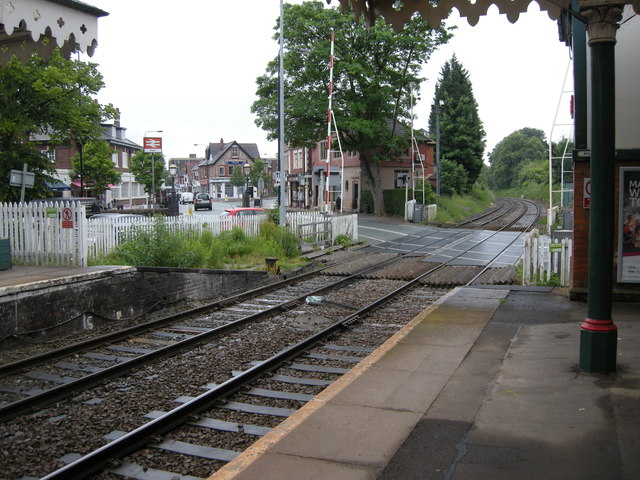
Image: © Richard Sutcliffe Taken: 20 Jun 2015
The level crossing at the southern end of Hale Station. Ashley Road crosses the line which leads to Chester. The crossing today consists of automatic barriers. The original level crossing had four gates - two large and two small, which moved sequentially in order to open and close the gates across the diagonal crossing. They were operated by a large wheel, turned by the signalman in the signalbox, which is just behind the pillar at the far right of the photograph.
Images are licensed for reuse under creativecommons.org/licenses/by-sa/2.0
Image Location
Latitude
53.378086
Longitude
-2.347502