Site of Sloane Street, Brighton
Introduction
The photograph on this page of Site of Sloane Street, Brighton by Simon Carey as part of the Geograph project.
The Geograph project started in 2005 with the aim of publishing, organising and preserving representative images for every square kilometre of Great Britain, Ireland and the Isle of Man.

There are currently over 7.5m images from over 14,400 individuals and you can help contribute to the project by visiting https://www.geograph.org.uk
Site of Sloane Street, Brighton
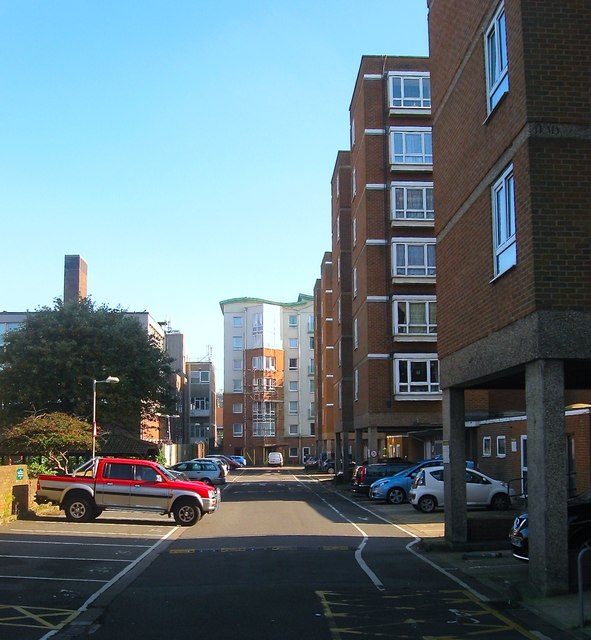
Image: © Simon Carey Taken: 1 Nov 2015
The course of the service road for Leach Court, Sloan Court and Patching Lodge follows what would have been the northern row of terraced housing on Sloan Street which was developed in the 1820s and demolished and removed from the map in the late 1960s. The street contained two pubs; The Rifleman, closed in 1911, and the Cadogan Arms that closed in 1943. See http://regencysociety-jamesgray.com/volume22/source/jg_22_123.html for a view in 1961. Behind the tree on the left is the Brighton Telephone Exchange.
Images are licensed for reuse under creativecommons.org/licenses/by-sa/2.0
Image Location
Latitude
50.821745
Longitude
-0.126093