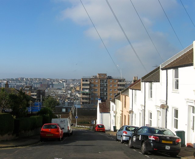
Richmond Street, Brighton
Introduction
The photograph on this page of Richmond Street, Brighton by Simon Carey as part of the Geograph project.
The Geograph project started in 2005 with the aim of publishing, organising and preserving representative images for every square kilometre of Great Britain, Ireland and the Isle of Man.
There are currently over 7.5m images from over 14,400 individuals and you can help contribute to the project by visiting https://www.geograph.org.uk

Image: © Simon Carey Taken: 1 Nov 2015
Once one of the steepest streets in Brighton that ran from Grand Parade to Queen's Park Road but has been truncated since the 1960s when the western end at the foot of the hill was renamed Richmond Parade and the rest ending at the junction with Elmore Road. The 1:5 incline necessitated the building of a wall across the road between Dinapore Street and Claremont Place to stop any runaway carts reaching the bottom of the street. The wall survived into the 1960s when it was removed with the rest of the street, see http://regencysociety-jamesgray.com/volume27/source/jg_27_080.html. The terrace on the right heading down to Image was built in the 1880s, see http://regencysociety-jamesgray.com/volume27/source/jg_27_052.html for a similar view taken around 1874 when the area was an open field used by Chates Farm. The steepness of the hill can be vouched by the high rise block, Richmond Heights, which is ten storeys but only six can be seen in this view. In the far distance is the North laine area along with International House on the western slope which is located next door to Brighton Station. Further up the slope is the West Hill area of the city.

