Buslingthorpe Vale
Introduction
The photograph on this page of Buslingthorpe Vale by Stephen Craven as part of the Geograph project.
The Geograph project started in 2005 with the aim of publishing, organising and preserving representative images for every square kilometre of Great Britain, Ireland and the Isle of Man.

There are currently over 7.5m images from over 14,400 individuals and you can help contribute to the project by visiting https://www.geograph.org.uk
Buslingthorpe Vale
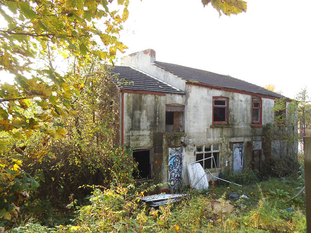
Image: © Stephen Craven Taken: 31 Oct 2015
The Vale was once a footpath (probably paved) running directly up the hillside from Sheepscar Beck to this point on Buslingthorpe Lane. The path is now inaccessible and these few derelict houses are all that remain.
Images are licensed for reuse under creativecommons.org/licenses/by-sa/2.0
Image Location
Latitude
53.815361
Longitude
-1.542953