Geometric field pattern on drumlin
Introduction
The photograph on this page of Geometric field pattern on drumlin by Eric Jones as part of the Geograph project.
The Geograph project started in 2005 with the aim of publishing, organising and preserving representative images for every square kilometre of Great Britain, Ireland and the Isle of Man.

There are currently over 7.5m images from over 14,400 individuals and you can help contribute to the project by visiting https://www.geograph.org.uk
Geometric field pattern on drumlin
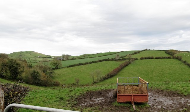
Image: © Eric Jones Taken: 31 Oct 2015
These are mostly hedges, but often with stone walls along the spines of the drumlins. This large drumlin runs parallel with both Dunturk Road and Carnreagh Road. The peak on the left is Dunturk Mountain. Dunturk Hill is an outpost of the Slieve Croob Range. Composed of igneous rocks between 250 and 400 million years old it stands above the surrounding drumlins formed by moving ice only some 13,000 years ago.
Images are licensed for reuse under creativecommons.org/licenses/by-sa/2.0
Image Location
Latitude
54.325888
Longitude
-5.914987