Zion Gardens, Brighton
Introduction
The photograph on this page of Zion Gardens, Brighton by Simon Carey as part of the Geograph project.
The Geograph project started in 2005 with the aim of publishing, organising and preserving representative images for every square kilometre of Great Britain, Ireland and the Isle of Man.

There are currently over 7.5m images from over 14,400 individuals and you can help contribute to the project by visiting https://www.geograph.org.uk
Zion Gardens, Brighton
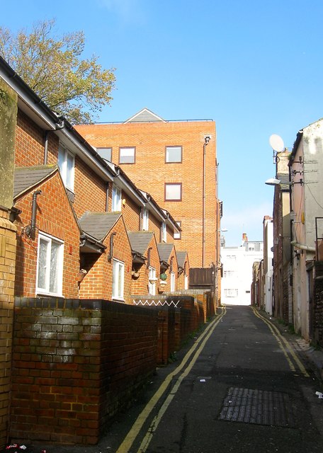
Image: © Simon Carey Taken: 1 Nov 2015
A narrow back street that runs from Air Street to Church Street that was originally developed in the 1800s though nothing remains from that period. Whatever was on the eastern side was swept away in 1845 when Queen's Road was built. The eastern side survived a little longer containing three storied cottages and the Ear, Nose and Throat Hospital. The latter had been built in 1897 on the site of an old brewery and continued in operation until 1986 when services were transferred to the Royal Sussex. The building was demolished in 1988 and replaced by a block of flats, St Nicolas Lodge. The cottages were demolished in 1966 but not replaced for a considerable time though now occupied by a small terrace. See http://regencysociety-jamesgray.com/volume31/source/jg_31_105.html for a 1956 view.
Images are licensed for reuse under creativecommons.org/licenses/by-sa/2.0
Image Location
Latitude
50.824721
Longitude
-0.143438