Boundary Stone: Oxford
Introduction
The photograph on this page of Boundary Stone: Oxford by Dylan Moore as part of the Geograph project.
The Geograph project started in 2005 with the aim of publishing, organising and preserving representative images for every square kilometre of Great Britain, Ireland and the Isle of Man.

There are currently over 7.5m images from over 14,400 individuals and you can help contribute to the project by visiting https://www.geograph.org.uk
Boundary Stone: Oxford
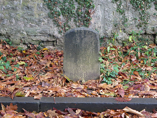
Image: © Dylan Moore Taken: 29 Oct 2015
The easy task of explaining this turned out to be time consuming. "Northgate Hundred" was apparently originally the part of the Liberty of Oxford outside the town walls. It was not a Hundred in the usually accepted sense. By the sixteenth century, St Mary Magdalen parish had been detached from it, so the boundary ran along the northern edge of the lands of Trinity and St John's Colleges. There is another stone on St Giles, outside No. 42. By the time these stones were laid, their significance was already purely antiquarian.
Images are licensed for reuse under creativecommons.org/licenses/by-sa/2.0
Image Location


Leaflet Map data © OpenStreetMap
Latitude
51.756686
Longitude
-1.255773