Thinhope Viaduct
Introduction
The photograph on this page of Thinhope Viaduct by Tiger as part of the Geograph project.
The Geograph project started in 2005 with the aim of publishing, organising and preserving representative images for every square kilometre of Great Britain, Ireland and the Isle of Man.

There are currently over 7.5m images from over 14,400 individuals and you can help contribute to the project by visiting https://www.geograph.org.uk
Thinhope Viaduct
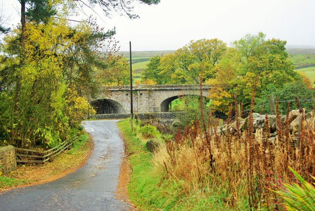
Image: © Tiger Taken: 30 Oct 2015
Two of the elliptical skew arches of the viaduct built in 1852 for the Alston branch railway and now carrying the South Tyne Trail, viewed from the side road to Knarsdale Church and the Kirkstyle Inn. Pevsner's revisers in 1992 suggested that the engineer responsible may have been George Barclay Bruce. The left-hand arch carries the trackbed over the Thinhope Burn which flows into the South Tyne and the broader arch on the right crosses the A689 road leading from Alston to Brampton, which itself crosses the burn by an older bridge.
Images are licensed for reuse under creativecommons.org/licenses/by-sa/2.0
Image Location
Latitude
54.88275
Longitude
-2.507633