Lumb Railway Viaduct
Introduction
The photograph on this page of Lumb Railway Viaduct by David Dixon as part of the Geograph project.
The Geograph project started in 2005 with the aim of publishing, organising and preserving representative images for every square kilometre of Great Britain, Ireland and the Isle of Man.

There are currently over 7.5m images from over 14,400 individuals and you can help contribute to the project by visiting https://www.geograph.org.uk
Lumb Railway Viaduct
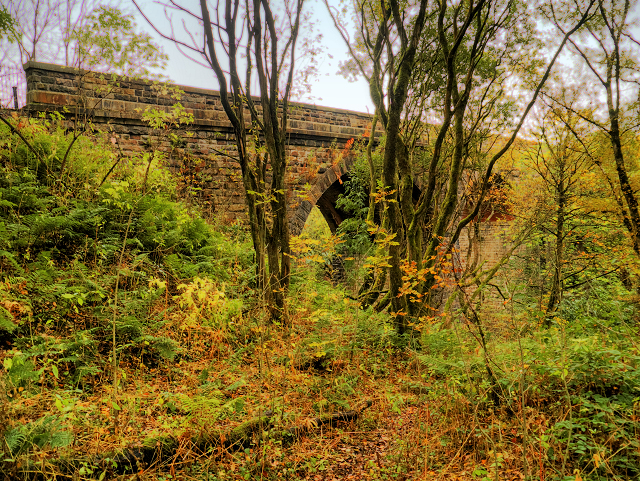
Image: © David Dixon Taken: 25 Oct 2015
This disused viaduct carried the now-closed line to Accrington that diverged from the East Lancashire line just to the north of north of Ramsbottom. It was built in 1846 and has nine segmental arches each 40 feet in span and boasting red brick soffits. These enabled the railway to reach a height of 60 feet over the River Irwell. It is a grade II listed building (English Heritage Building ID: 185710 http://www.britishlistedbuildings.co.uk/en-185710-railway-viaduct-lancashire#.VjP-SXknyHs British Listed Buildings). The line was closed in 1966 and has since been dismantled.
Images are licensed for reuse under creativecommons.org/licenses/by-sa/2.0
Image Location
Latitude
53.673882
Longitude
-2.319962