Cambois Miners Welfare Institute
Introduction
The photograph on this page of Cambois Miners Welfare Institute by Oliver Dixon as part of the Geograph project.
The Geograph project started in 2005 with the aim of publishing, organising and preserving representative images for every square kilometre of Great Britain, Ireland and the Isle of Man.

There are currently over 7.5m images from over 14,400 individuals and you can help contribute to the project by visiting https://www.geograph.org.uk
Cambois Miners Welfare Institute
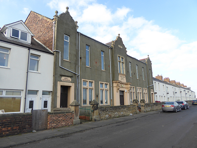
Image: © Oliver Dixon Taken: 26 Oct 2015
This striking building appears to date from 1926. The door to the left is marked "Hall entrance", to the right "Platform entrance".
Images are licensed for reuse under creativecommons.org/licenses/by-sa/2.0
Image Location
Latitude
55.145717
Longitude
-1.521293