Clints Quarry - Limestones
Introduction
The photograph on this page of Clints Quarry - Limestones by Ashley Dace as part of the Geograph project.
The Geograph project started in 2005 with the aim of publishing, organising and preserving representative images for every square kilometre of Great Britain, Ireland and the Isle of Man.

There are currently over 7.5m images from over 14,400 individuals and you can help contribute to the project by visiting https://www.geograph.org.uk
Clints Quarry - Limestones
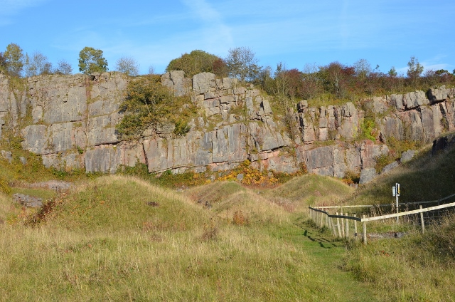
Image: © Ashley Dace Taken: 27 Oct 2015
Large limestone quarry exploiting large beds of clean limestone for iron making and lime production. The limestones are Dinantian in age (Early Carboniferous, around 350 million years old) and belong to the Chief Limestone Group. This whole quarry mined the fourth limestone which is split into a variety of other smaller limestones. At the time of formation Britain was around the equator, the limestones formed on a proximal inner carbonate ramp on the shores of the Lake District Island! In the quarry algal mats, corals (rugose), braciopods and other sea creatures are present. Sea level changes often meant the limestones were eroded and caves formed (think Zanzibar for an analogue). Another feature described in this quarry are the bentonite bands (clays) which are the remains of volcanic ash fall outs.
Images are licensed for reuse under creativecommons.org/licenses/by-sa/2.0
Image Location
Latitude
54.498353
Longitude
-3.533546