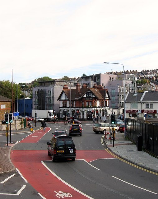
Vogue Gyratory, Brighton
Introduction
The photograph on this page of Vogue Gyratory, Brighton by Simon Carey as part of the Geograph project.
The Geograph project started in 2005 with the aim of publishing, organising and preserving representative images for every square kilometre of Great Britain, Ireland and the Isle of Man.
There are currently over 7.5m images from over 14,400 individuals and you can help contribute to the project by visiting https://www.geograph.org.uk

Image: © Simon Carey Taken: 25 Oct 2015
A one way system opened in 1984 joining up the junctions of Upper Lewes Road, Hollingdean Roand Bear Road with Lewes Road creating possibly the worst road junction in Brighton as a result. Adding to the traffic is a filling station, see Image, in the island and the car park of Sainsbury's. Often congested and occasionally gridlocked it isn't a pleasant junction to negotiate. There was talk of demolishing all buildings in the middle and reconstituting the junction but when work did occur all that has happened is clearer cycle lanes have been added, which given the route to the universities was probably needed as the old junction was dangerous for cyclists. Viewed from the car park at Sainsbury's and looking towards the Bear Inn. The fencing on the right marks the site of the Allen Arms an old pub that spent its last years changing its name with increasing regularity before finally being demolished to be replaced by student flats.

