South side of The Olde House, Dodington, Whitchurch
Introduction
The photograph on this page of South side of The Olde House, Dodington, Whitchurch by Jaggery as part of the Geograph project.
The Geograph project started in 2005 with the aim of publishing, organising and preserving representative images for every square kilometre of Great Britain, Ireland and the Isle of Man.

There are currently over 7.5m images from over 14,400 individuals and you can help contribute to the project by visiting https://www.geograph.org.uk
South side of The Olde House, Dodington, Whitchurch
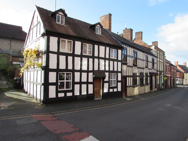
Image: © Jaggery Taken: 22 Oct 2015
The Discover Shropshire website states that The Olde House, number 7 Dodington, is a mid-17th century box-framed town house of modest proportions, dated 1651. Almost all of the end wall timbers are facsimiles though remarkably accurate, in keeping with the design of the original box-framing. http://www.geograph.org.uk/photo/4715970 to another view.
Images are licensed for reuse under creativecommons.org/licenses/by-sa/2.0
Image Location
Latitude
52.967189
Longitude
-2.682331