Boar Lane
Introduction
The photograph on this page of Boar Lane by Bob Harvey as part of the Geograph project.
The Geograph project started in 2005 with the aim of publishing, organising and preserving representative images for every square kilometre of Great Britain, Ireland and the Isle of Man.

There are currently over 7.5m images from over 14,400 individuals and you can help contribute to the project by visiting https://www.geograph.org.uk
Boar Lane
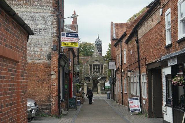
Image: © Bob Harvey Taken: 15 Oct 2015
One of the medieval streets that make walking round Newark such a pleasure. Most of the buildings are, of course, Victorian or even early 20th century. But the streetplan is far older. Look how the road aligns on the Gilstrap Library, itself built on a former open space in front of the Castle. This is a very old alignment between the Castle and the market place.
Images are licensed for reuse under creativecommons.org/licenses/by-sa/2.0
Image Location
Latitude
53.077195
Longitude
-0.811147