Chester Road, St Georges
Introduction
The photograph on this page of Chester Road, St Georges by Gerald England as part of the Geograph project.
The Geograph project started in 2005 with the aim of publishing, organising and preserving representative images for every square kilometre of Great Britain, Ireland and the Isle of Man.

There are currently over 7.5m images from over 14,400 individuals and you can help contribute to the project by visiting https://www.geograph.org.uk
Chester Road, St Georges
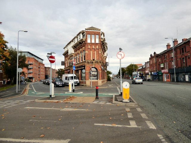
Image: © Gerald England Taken: 17 Oct 2015
The A56 into Manchester. The former Turville Public House on the corner of Ellesmere Street and Chester Road is a Grade II listed building http://www.britishlistedbuildings.co.uk/en-388008-turville-public-house- It dates back to the 1870s and was granted a spirits licence in 1896. It was originally the Commercial Hotel. later becoming the Turville and then the Last Hop. http://pubs-of-manchester.blogspot.co.uk/2011/03/turville-commercial-hotel-chester-road.html It is now home to Insitu Architectural Salvage http://www.insitumanchester.com/about-us/
Images are licensed for reuse under creativecommons.org/licenses/by-sa/2.0
Image Location
Latitude
53.469891
Longitude
-2.265096