Ardlair Recumbent Stone Circle (4)
Introduction
The photograph on this page of Ardlair Recumbent Stone Circle (4) by Anne Burgess as part of the Geograph project.
The Geograph project started in 2005 with the aim of publishing, organising and preserving representative images for every square kilometre of Great Britain, Ireland and the Isle of Man.

There are currently over 7.5m images from over 14,400 individuals and you can help contribute to the project by visiting https://www.geograph.org.uk
Ardlair Recumbent Stone Circle (4)
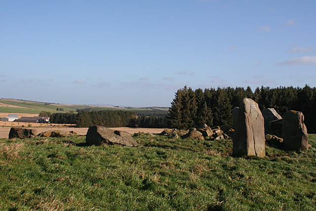
Image: © Anne Burgess Taken: 22 Oct 2015
The circle from the west, with the one remaining standing stone in the foreground and several fallen ones to the left. Also several smaller stones that seem to have been dumped in the circle.See http://canmore.org.uk/site/17641/ardlair#668469 for full details. The farm in the distance is Broadgate. Image]
Images are licensed for reuse under creativecommons.org/licenses/by-sa/2.0
Image Location
Latitude
57.33977
Longitude
-2.744906