Kearn Kirkyard (1)
Introduction
The photograph on this page of Kearn Kirkyard (1) by Anne Burgess as part of the Geograph project.
The Geograph project started in 2005 with the aim of publishing, organising and preserving representative images for every square kilometre of Great Britain, Ireland and the Isle of Man.

There are currently over 7.5m images from over 14,400 individuals and you can help contribute to the project by visiting https://www.geograph.org.uk
Kearn Kirkyard (1)
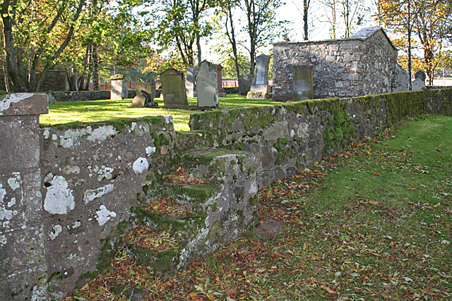
Image: © Anne Burgess Taken: 22 Oct 2015
The map names this as Kearn Church, but there doesn't seem to be anything left of the kirk itself. Note the steps up the outside wall. These are matched by steps down the inside wall, and were a means for people to get in and out of the kirkyard but exclude cattle. They would be pretty ineffective against sheep, however, which suggests that when the kirkyard wall was built, sheep were not so common. See http://canmore.org.uk/site/17659/kearn-old-parish-church-and-churchyard#668185 for details.
Images are licensed for reuse under creativecommons.org/licenses/by-sa/2.0
Image Location
Latitude
57.327613
Longitude
-2.807935