Hell Kettle Weir
Introduction
The photograph on this page of Hell Kettle Weir by Matthew Hatton as part of the Geograph project.
The Geograph project started in 2005 with the aim of publishing, organising and preserving representative images for every square kilometre of Great Britain, Ireland and the Isle of Man.

There are currently over 7.5m images from over 14,400 individuals and you can help contribute to the project by visiting https://www.geograph.org.uk
Hell Kettle Weir
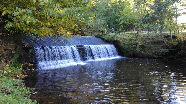
Image: © Matthew Hatton Taken: 19 Oct 2015
Built to provide a head of water for Borrowby Mill which is half a mile downstream. The mill itself is Grade II Listed and was built in the 18thC so it would be an educated guess that this weir is of a similar date. Broad Beck that flows over the weir is relatively shallow for the most part, and is a collection of the small streams that come down off the edge of the Hambleton Hills. It joins the slightly larger Cod Beck at SE409 876 behind Brawith Hall just over 2 miles away.
Images are licensed for reuse under creativecommons.org/licenses/by-sa/2.0
Image Location
Latitude
54.294604
Longitude
-1.334706