OUT KEEP: The eroded arch at St Audries bay, Doniford
Introduction
The photograph on this page of OUT KEEP: The eroded arch at St Audries bay, Doniford by Oliver Mills as part of the Geograph project.
The Geograph project started in 2005 with the aim of publishing, organising and preserving representative images for every square kilometre of Great Britain, Ireland and the Isle of Man.

There are currently over 7.5m images from over 14,400 individuals and you can help contribute to the project by visiting https://www.geograph.org.uk
OUT KEEP: The eroded arch at St Audries bay, Doniford
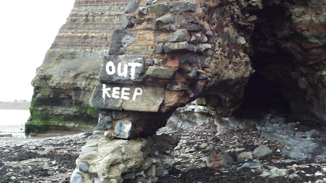
Image: © Oliver Mills Taken: 25 Jul 2009
The precarious-looking arch by the cliffs of St Audries bay. It collapsed the following year.
Images are licensed for reuse under creativecommons.org/licenses/by-sa/2.0
Image Location


Leaflet Map data © OpenStreetMap
Latitude
51.180293
Longitude
-3.280814