Red Road flats
Introduction
The photograph on this page of Red Road flats by Thomas Nugent as part of the Geograph project.
The Geograph project started in 2005 with the aim of publishing, organising and preserving representative images for every square kilometre of Great Britain, Ireland and the Isle of Man.

There are currently over 7.5m images from over 14,400 individuals and you can help contribute to the project by visiting https://www.geograph.org.uk
Red Road flats
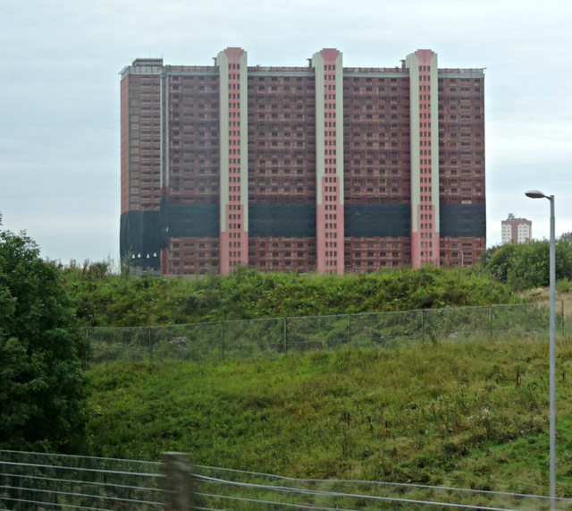
Image: © Thomas Nugent Taken: 10 Oct 2015
The easternmost of the Red Road towerblocks, viewed from a train the day before the six remaining blocks were demolished by explosives.
Images are licensed for reuse under creativecommons.org/licenses/by-sa/2.0
Image Location
Latitude
55.879489
Longitude
-4.206731