
Discovering RAF Ibsley: Mockbeggar Lane technical site (1)
Introduction
The photograph on this page of Discovering RAF Ibsley: Mockbeggar Lane technical site (1) by Mike Searle as part of the Geograph project.
The Geograph project started in 2005 with the aim of publishing, organising and preserving representative images for every square kilometre of Great Britain, Ireland and the Isle of Man.

There are currently over 7.5m images from over 14,400 individuals and you can help contribute to the project by visiting https://www.geograph.org.uk
Discovering RAF Ibsley: Mockbeggar Lane technical site (1)
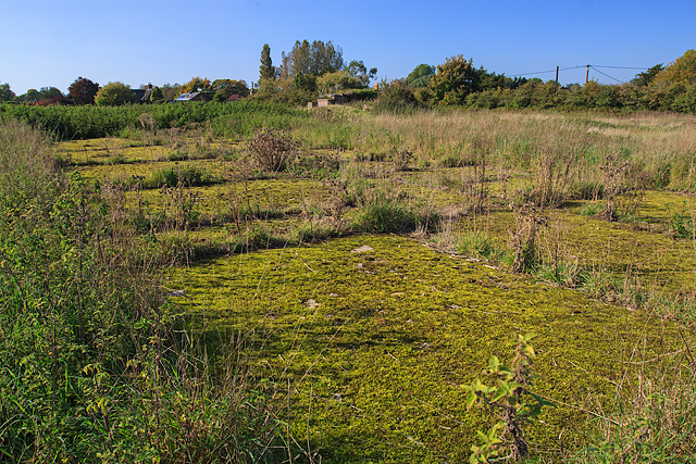
Image: © Mike Searle Taken: 12 Oct 2015
A dispersal site located on the north side of the airfield in a field at Ibsley Farm on the south side of Mockbeggar Lane. It comprised a number of different installations that included several fighter dispersal pens for at least six aircraft, accommodation for personnel, and air raid shelters, several of which also survive in the paddocks of adjacent private properties. A circular gun pit exists somewhere, but I was unable to find it; no doubt it now lies buried somewhere under the grass. This view is of the foundations of a large building amongst those of at least two others, seen also in this Google Earth view of the site that show traces of the concrete aprons of some of the aircraft dispersal pens that are now invisible at ground level. https://www.google.co.uk/maps/@50.8823583,-1.784745,205m/data=!3m1!1e3 Image
Images are licensed for reuse under creativecommons.org/licenses/by-sa/2.0
Image Location

Latitude
50.882545
Longitude
-1.785588