A former church building, Cupar
Introduction
The photograph on this page of A former church building, Cupar by Stanley Howe as part of the Geograph project.
The Geograph project started in 2005 with the aim of publishing, organising and preserving representative images for every square kilometre of Great Britain, Ireland and the Isle of Man.

There are currently over 7.5m images from over 14,400 individuals and you can help contribute to the project by visiting https://www.geograph.org.uk
A former church building, Cupar
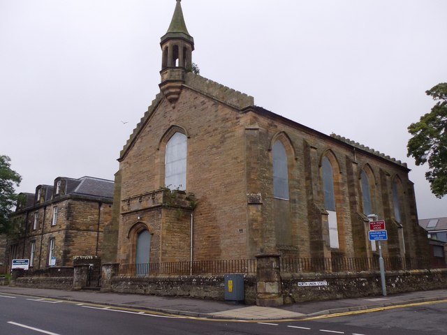
Image: © Stanley Howe Taken: 6 Oct 2015
At the junction of North Union Street and West Port (A91). Built in C19 as St Michael's Church, Westport; subsequently used as a gymnasium by a local academy; now disused. See http://canmore.org.uk/site/99088/cupar-west-port-st-michaels-church
Images are licensed for reuse under creativecommons.org/licenses/by-sa/2.0
Image Location
Latitude
56.319057
Longitude
-3.019158