Somerset Street, Kemp Town, Brighton
Introduction
The photograph on this page of Somerset Street, Kemp Town, Brighton by Simon Carey as part of the Geograph project.
The Geograph project started in 2005 with the aim of publishing, organising and preserving representative images for every square kilometre of Great Britain, Ireland and the Isle of Man.

There are currently over 7.5m images from over 14,400 individuals and you can help contribute to the project by visiting https://www.geograph.org.uk
Somerset Street, Kemp Town, Brighton
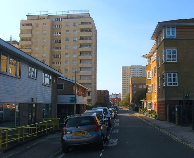
Image: © Simon Carey Taken: 11 Oct 2015
Originally a residential street that ran from Montague Place to Upper Bedford Street that was developed in the 1820s. All the street was removed in the mid 1960s and redeveloped. See http://regencysociety-jamesgray.com/volume22/source/jg_22_199.html for an image taken in 1954. The high rise block on the left is Somerset Point with Hereford House in the distance to the right. In the foreground on the right hand side is the rear to Evelyn Glennie Court.
Images are licensed for reuse under creativecommons.org/licenses/by-sa/2.0
Image Location
Latitude
50.820374
Longitude
-0.124728