Manchester, Stevenson Square
Introduction
The photograph on this page of Manchester, Stevenson Square by David Dixon as part of the Geograph project.
The Geograph project started in 2005 with the aim of publishing, organising and preserving representative images for every square kilometre of Great Britain, Ireland and the Isle of Man.

There are currently over 7.5m images from over 14,400 individuals and you can help contribute to the project by visiting https://www.geograph.org.uk
Manchester, Stevenson Square
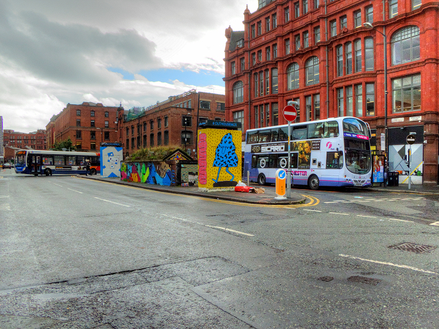
Image: © David Dixon Taken: 5 Oct 2015
In the 1960s and 1970s, Stevenson Square was a bustling bus terminus. Now, it all looks sadly run down and dilapidated even though it is only about 250 yards from Piccadilly. Street art has been employed in an attempt to brighten it up with brightly coloured (gaudy) artwork on some of the shutters and on the former toilet block which is used to display street art which is changed every three months and also has a roof garden.
Images are licensed for reuse under creativecommons.org/licenses/by-sa/2.0
Image Location
Latitude
53.48272
Longitude
-2.234134