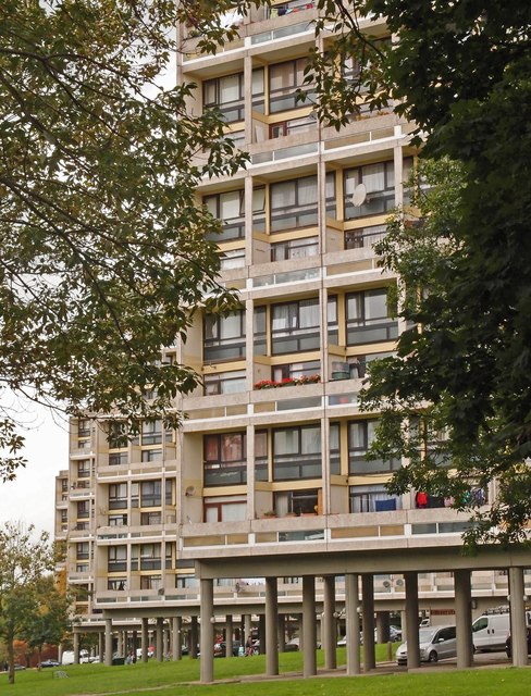
Housing blocks, Alton West Estate, Roehampton
Introduction
The photograph on this page of Housing blocks, Alton West Estate, Roehampton by Jim Osley as part of the Geograph project.
The Geograph project started in 2005 with the aim of publishing, organising and preserving representative images for every square kilometre of Great Britain, Ireland and the Isle of Man.
There are currently over 7.5m images from over 14,400 individuals and you can help contribute to the project by visiting https://www.geograph.org.uk

Image: © Jim Osley Taken: 10 Oct 2015
Series of five 'slab' blocks - Dunbridge House, Denmead House, Charcot House, Winchfield House, and Binley House - built in the 1950s to the designs of the London County Council Architects' Department. Grade II* listed - "They are the centrepiece of the Alton West estate, the LCC's most ambitious post-war development scheme and considered 'probably the finest low-cost housing development in the world' (G E Kidder Smith). It remains very highly regarded." - quoted from this https://historicengland.org.uk/listing/the-list/list-entry/1246040.

