
Barrow Island
Introduction
The photograph on this page of Barrow Island by Rude Health as part of the Geograph project.
The Geograph project started in 2005 with the aim of publishing, organising and preserving representative images for every square kilometre of Great Britain, Ireland and the Isle of Man.

There are currently over 7.5m images from over 14,400 individuals and you can help contribute to the project by visiting https://www.geograph.org.uk
Barrow Island
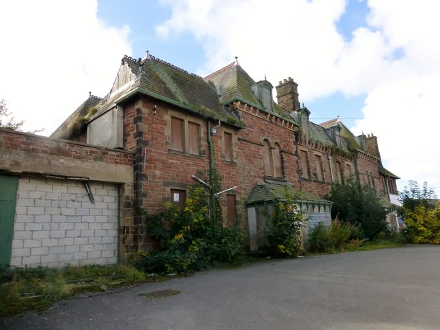
Image: © Rude Health Taken: 8 Oct 2015
A view of the front of the ruined building on the summit of Barrow Island which is currently for sale. Parked on Farm Street and walked around to derelict building which looks higher than the high point of Dundee Street which was also bagged. Name: Barrow Island Hill number: 19089 Height: 17m / 56ft Parent (Ma/M): 2668 Kirkby Moor [Lowick High Common] Section: 34D: Southern Cumbria County/UA: Cumbria (CoU) Maritime Area: England - Cheshire Coast to Barrow Class: SIB Grid ref: SD 19811 68401 Summit feature: no feature: ground at rear of derelict building Drop: 11m Col: 6m SD190690 Comments: deemed to be an island because of its original, pre-shipyard, condition
Images are licensed for reuse under creativecommons.org/licenses/by-sa/2.0
Image Location

Latitude
54.105212
Longitude
-3.227778