The North Circular Road (A406) (2)
Introduction
The photograph on this page of The North Circular Road (A406) (2) by Mike Quinn as part of the Geograph project.
The Geograph project started in 2005 with the aim of publishing, organising and preserving representative images for every square kilometre of Great Britain, Ireland and the Isle of Man.

There are currently over 7.5m images from over 14,400 individuals and you can help contribute to the project by visiting https://www.geograph.org.uk
The North Circular Road (A406) (2)
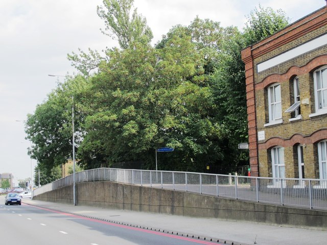
Image: © Mike Quinn Taken: 9 Sep 2015
Before 1962/63, when the North Circular Road was enlarged, there was a hump-backed bridge over the New River at this point. It was not possible to raise sufficiently the level of the new road under the nearby railway bridge just to the west Image So the aqueduct was put into a U-bend conduit under the road. However, the pavement on the south side of the road still rises in an arc some 8 ft above the level of the carriageway (to the height of the original bridge). See also Image for info about the New River.
Images are licensed for reuse under creativecommons.org/licenses/by-sa/2.0
Image Location
Latitude
51.612405
Longitude
-0.114943