Bishop Percy's House, Bridgnorth
Introduction
The photograph on this page of Bishop Percy's House, Bridgnorth by Ian Taylor as part of the Geograph project.
The Geograph project started in 2005 with the aim of publishing, organising and preserving representative images for every square kilometre of Great Britain, Ireland and the Isle of Man.

There are currently over 7.5m images from over 14,400 individuals and you can help contribute to the project by visiting https://www.geograph.org.uk
Bishop Percy's House, Bridgnorth
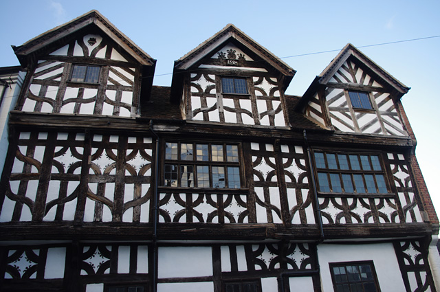
Image: © Ian Taylor Taken: 25 Sep 2015
The upper storeys of this timbered house, dated 1580. See Image for a wider view with further information. This is Grade I listed - https://historicengland.org.uk/listing/the-list/list-entry/1367867 & http://www.britishlistedbuildings.co.uk/en-254375-bishop-percy-s-house-bridgnorth-#.VhWpCHldGUk.
Images are licensed for reuse under creativecommons.org/licenses/by-sa/2.0
Image Location
Latitude
52.534847
Longitude
-2.417168