The Falstaff, 18 Addington Street
Introduction
The photograph on this page of The Falstaff, 18 Addington Street by John Baker as part of the Geograph project.
The Geograph project started in 2005 with the aim of publishing, organising and preserving representative images for every square kilometre of Great Britain, Ireland and the Isle of Man.

There are currently over 7.5m images from over 14,400 individuals and you can help contribute to the project by visiting https://www.geograph.org.uk
The Falstaff, 18 Addington Street
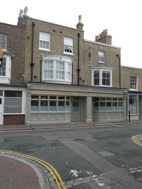
Image: © John Baker Taken: 15 Sep 2015
Here Image is seen with the ground floor covered with, what appears to be, plastic sheeting. Planning permission was granted by Thanet District Council under application number L/TH/14/0190 for the “change of use from public house with guest and function rooms to guest house with guest function and guest dining room open to the public”. It is a grade II listed building that was built, as a public house, between 1801 and 1821; it was then altered in the late 19th century. It was originally two separate private houses and this was indicated, as such, on Collard and Hurst’s 1821 plan of Ramsgate http://www.britishlistedbuildings.co.uk/en-171648-the-falstaff-ramsgate-kent#.VhVd3MKFPcc
Images are licensed for reuse under creativecommons.org/licenses/by-sa/2.0
Image Location
Latitude
51.330853
Longitude
1.414516