Bridge across nothing
Introduction
The photograph on this page of Bridge across nothing by Alan Murray-Rust as part of the Geograph project.
The Geograph project started in 2005 with the aim of publishing, organising and preserving representative images for every square kilometre of Great Britain, Ireland and the Isle of Man.

There are currently over 7.5m images from over 14,400 individuals and you can help contribute to the project by visiting https://www.geograph.org.uk
Bridge across nothing
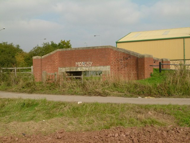
Image: © Alan Murray-Rust Taken: 4 Oct 2015
Numbered 41B, this carries the Chesterfield Canal towpath across what was the mouth of the branch to Lady Lee. This served limestone quarries and limekilns, and was disused by the early 20th century although maps show that it continued in water until around 1960, possibly acting as a feeder from the River Ryton. This end of the branch had been ploughed out by the 1960s, and all immediate trace finally obliterated by the construction of the Worksop bypass in the 1980s. It's surprising that such a modern bridge exists when its function had disappeared so long ago.
Images are licensed for reuse under creativecommons.org/licenses/by-sa/2.0
Image Location
Latitude
53.311052
Longitude
-1.140716